Another round of snow in Metro Detroit brings low visibility, crashes
 Hani Barghouthi
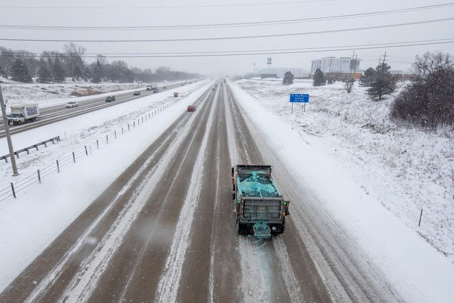
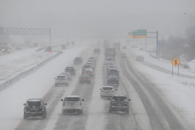
A cold snap and a second snow system are bringing up to another 3 inches of snow Monday to Metro Detroit, adding to around 1 to 2 inches that fell Saturday night into Sunday morning, the National Weather Service said.

Steve Considine, a meteorologist with the weather service in White Lake Township, said temperatures in the lower 20s will feel colder due to a brisk north wind bringing wind chill readings into the teens, and Sunday lows may hit 10 degrees.
Another "weak system" that originates from the Alberta province in Canada is making its way across the state Monday, triggering another round of light snow of 2 to 3 inches in Metro Detroit, Considine said.
"We call these clipper systems. (They are) typically fast moving and weak systems with not a lot of moisture with them," said Considine.
A winter weather advisory is in effect for Shiawassee, Genesee, Lapeer, St. Clair, Livingston, Oakland, Macomb, Washtenaw and Wayne counties until 7 p.m.
"Snow will overspread the region this morning and persist through the afternoon with snowfall rates of one half an inch per hour common by midday with rates near one inch per hour rates possible at times," according to the advisory.
The Michigan Department of Transportation said southbound Interstate 75 was closed for more than an hour at Newport Road in Monroe County due to a crash, and the MI Drive map shows numerous crashes in the Metro Detroit area.
Some snowfall is expected during the afternoon rush hour Monday, which may lead to minor travel disruptions and slower traffic, added Considine, but warmer temperatures in the mid- to upper-20s may help road salt melt the snow faster.

A cold week lies ahead for Metro Detroiters after Monday, with wind chills in the single digits starting Tuesday, dipping to below zero with arctic air on Wednesday. Thursday will get a little warmer with highs in the mid-20s.
The next chance of any snow may be Friday, Considine said.
"But even going out through next weekend, it looks to be pretty much on the cold side of normal with highs generally in the 20s and overnight lows in the teens," he said.
The National Weather Service announced last week that its KDTX radar in White Lake Township, which services southeast Michigan, would be down for around two weeks as technicians replace its pedestal.

Radars at Detroit Metro Airport and in Grand Rapids and Cleveland are expected to fill the coverage gaps as KDTX gets serviced, said Considine, who explained that radars across the country that have been operational for around 30 years have undergone similar processes across the country in recent years.
halbarghouthi@detroitnews.com
@HaniBarghouthi